Thursday 19th March 2026
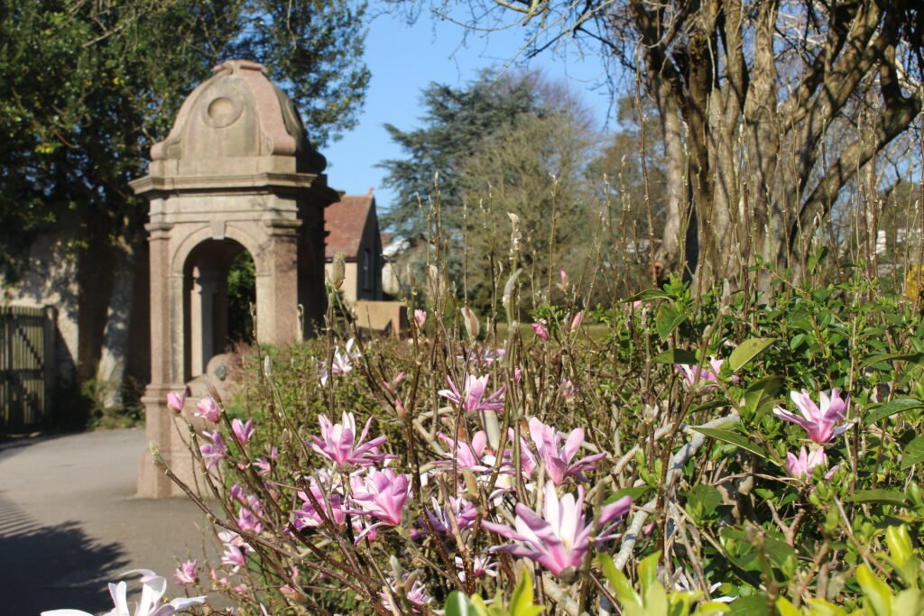
It’s been glorious, weatherwise, in Warminster today. Someone has remarked this photo of mine, taken in the Lake Pleasure Grounds (Town Park) this afternoon, would make a teaser of a jigsaw?
Sharing Local Knowledge About Warminster And District
Thursday 19th March 2026
It’s been glorious, weatherwise, in Warminster today. Someone has remarked this photo of mine, taken in the Lake Pleasure Grounds (Town Park) this afternoon, would make a teaser of a jigsaw?
Friday 13th March 2026
Hearts Of Fire is a film (musical drama) starring Bob Dylan, playing the part of a faded rock star called Billy Parker. The film also stars Rupert Everett.
IMDb describes the storyline as “A reclusive musician, once a huge rock star, takes a young female protegee. While on a tour she meets a younger, more popular rocker and switches her loyalties.”
Hearts Of Fire was announced in August 1986. The film was released in the UK on 9th October 1987 but only shown in cinemas for two weeks. It was later released on video cassette. The film was panned by the critics. Dylan never seemed too interested in it and later distanced himself from it.
Wikipedia states that the concert scenes in the film were shot at the Copps Coliseum in Hamilton, Ontario; Colston Hall in Bristol; and Camden, North London.
But people have told me some of the minor concert scenes were shot at the Athenaeum in Warminster, the Ath being privately booked for filming. And that students from Warminster School were among those invited to be the audience.
Can anyone confirm this? Were you working at the Ath at the time? Were you a student at Warminster School and in the audience? Is there any reference in the Athenaeum Archives?
If you have information about Hearts Of Fire and an Athenaeum connection, please email: dannyhowellnet@gmail.com
Thursday 12th March 2026
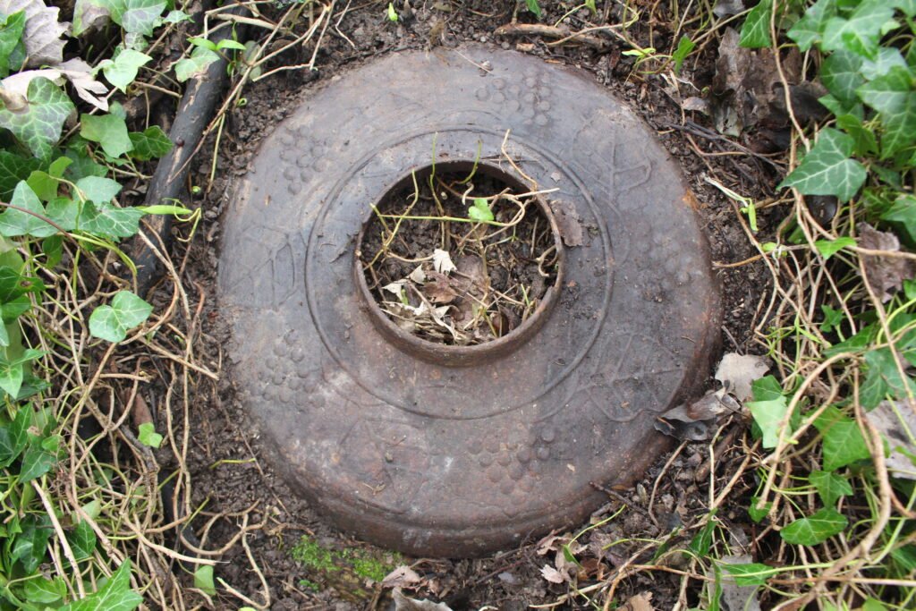
While out on an afternoon stroll with a friend the other day, we stumbled across an iron object hidden among the ivy beneath our feet in Primrose Wood (see photo above). It is about 15 inches across and resembles a lid. Whatever it was meant for or part of, someone went to the trouble of adding a decoration of leaves and berries to the ironwork. Has anyone ever seen one of these before? Does anyone know what it was used for? If you know, please email: dannyhowellnet@gmail.com
You must be logged in to view this content.
You must be logged in to view this content.
You must be logged in to view this content.
You must be logged in to view this content.
You must be logged in to view this content.
You must be logged in to view this content.
You must be logged in to view this content.