Extract from The Changing Face Of Warminster by Wilfred Middlebrook, published in 1971:
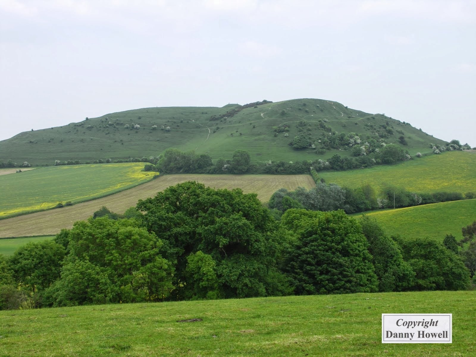
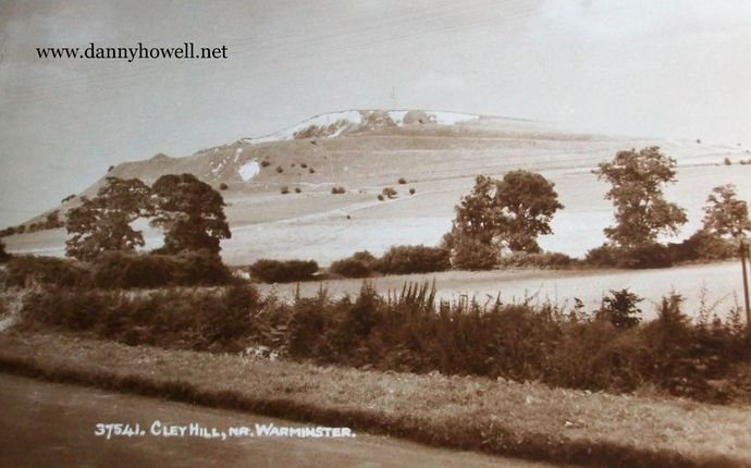
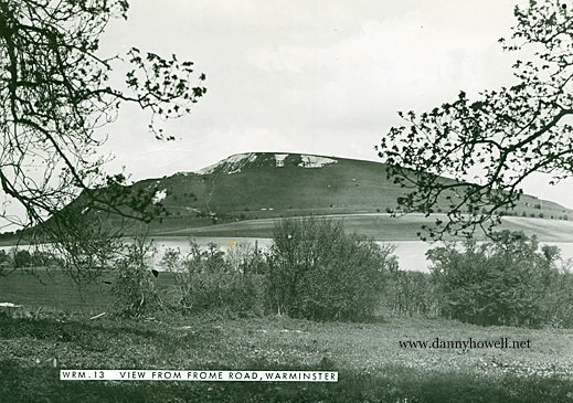
Where Folly Lane joins the Frome road at the foot of Half Mile Road, we find ourselves in close proximity to Cley Hill. This is the highest hill in the district, at 800 feet above sea level, and is a fitting eminence from which to end this account of western Warminster.
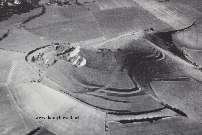
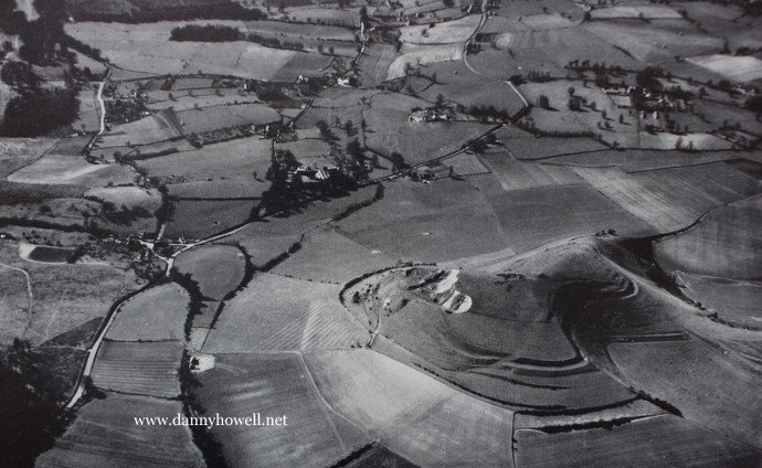
Cley Hill is a bold chalk down between Warminster and Frome, crowned by a large prehistoric tumulus, with deep trenches on the west side and terraces or lynchets on the south-eastern side, similar to those of Battlesbury. This is a watershed, all streams to the west of Cley Hill flowing down through Somerset and ending in the Bristol Channel. On the Warminster side of the hill, all streams flow to the east and south, ending at Christchurch, on the South Coast, via the Salisbury Avon.
Beacons have flared on this lonely height on several historic occasions. In the sixteenth century a beacon was erected on Cley Hill to warn the people of the possible invasion of England by the Spaniards, and Daniell records that the Constables of the Hundred ordered that the beacon “be well and sufficiently furnished with good and dry wood, and a barrel in which pitch hath been, besides five or six lbs. of pitch.” A watchman was appointed, and Mr. Carr of Corsley (no connection with our present Mr. Carr of Carr’s Cars), Mr. Blake of the Ashes, Richard Holway and Christopher Daniel of Norridge and Mr. Hobbs of Bugley, were “to look after the watchman and see that the Beacon was well and orderly watched, and fired only in just cause, nor without making the Justices of the Peace and Constables privy thereto.” Fortunately that particular Cley Hill beacon was never lit.
When the last beacon was erected on Cley Hill (to celebrate the Coronation of our present Queen in 1953) I took the opportunity of scaling the hill and having a chat with the Warminster Boy Scouts whose duty and pleasure it was to guard the inflammable pile and ignite it at the correct moment, to celebrate the Queen’s Coronation.
During the Second World War years, German bombers used Cley Hill as a landmark as they came up from the South Coast on their raids on Bristol and the Midlands.
Cley Hill was given to the National Trust in 1954 by the Marquess of Bath, who first announced his intention in 1947, and granted the tenancy to the Trust with the consent of his heir, Lord Weymouth, when the latter came of age.
A local saying declares that “When Big Cley Hill do wear a hat, Little Cley Hill do laugh at that.’ This refers to the storm clouds that often obscure the summit of the larger of the two hills that constitute Cley Hill, while its smaller twin is uncovered. As with Copheap there used to be the Palm Sunday ritual of chasing the Devil, in this case a hare instead of a fox. Farmers used to burn the grass to drive away demons, so that they could work their fields unhindered, and as recently as 1924 boys burned the grass on Cley Hill. There was also the Easter custom of rolling hard-boiled eggs down the hillside.
The Devil himself is credited with the formation of Cley Hill. It is said that he was angry with the people of Devizes and went down country to get a large enough hunk of dirt to throw at them. As he travelled back, with the hump on his shoulder, the Devil met an old man and asked him the way to Devizes. The old man replied “That’s just what I’d like to know myself. I started for Devizes when my beard was black and now it’s grey!” This so disgusted the Devil that he threw down the heap of dirt there and then, leaving us with Cley Hill, and the mighty Forest of Selwood as its footstool.
The hill stands by the borders of Somerset and Wiltshire, and in bygone days there was an annual contest of men from these two counties, fighting with fists and sticks to see which party could drive the other across the boundary line. The injured were thrown into the hedge out of the way as the bloody fight progressed.