
Friday 23rd January 2026
From the EBBRAG website – www.ebbrag.com – EBBRAG’s report of the Full Council Meeting of Warminster Town Council, last Monday evening, which saw the launch of the Warminster Neighbourhood Plan 2 for public consultation:
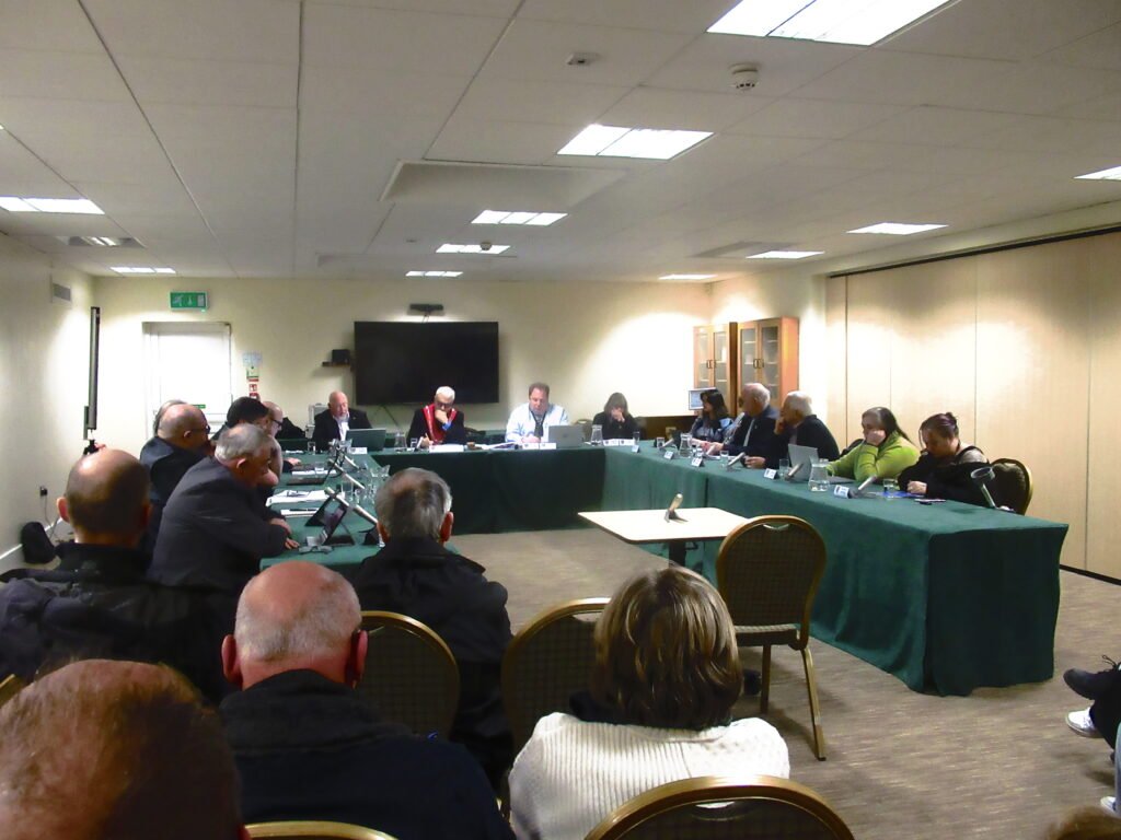
Warminster Town Council Extraordinary Meeting, Monday 19th January 2026
“Unfortunately last night’s Town Council meeting was no more than the political charade we could have expected it to be. Blind and ill-informed compliance by most of the councillors to an agenda set by an influential few, is how it came across to me.” – an angry comment from a member of the public after the meeting.
Warminster Town Council held an Extraordinary meeting on 19th January 2026, to vote on progressing the Neighbourhood Plan to Regulation 14. In plain English this means a discussion of whether the current process moves to its next phase of a formal public consultation on the draft plan document.
You may have missed the widespread publicity of this meeting, as there was none! They put the agenda on their Council agendas/minutes page one week ahead but that was all, they didn’t publicise that the meeting was taking place. So that’s why only 17 adult members of the public attended. Could it be the Town Council didn’t really want any public there?
Nick Parker, spoke as someone who has lived in Warminster for 28 years. He highlighted the exceptional level of housing development Warminster is undergoing and how the further 90 houses at Home Farm are not justified and indeed against Wiltshire Council Planning documents for Warminster. Warminster is already meeting its housing requirement and needs a coherent strategy for infrastructure to catch up. Will the inclusion of unsustainable housing development on the fields of Home Farm and elsewhere be the single issue which causes residents to reject the Plan altogether?
Tania Peacock also spoke about factual errors the Council had made regarding land in the Cannimore/Folly Lane area owned by her family, which has been classified as Local Green Space within the plan. She highlighted how the plan does not even get the name of this area correct, due democratic process has not been followed, there are spurious claims that there is public support for this land to be open space from a survey which was for a totally different purpose, the space is in fact a private fenced field and not as claimed an open space and the Council claims to have agreement from the landowner which is disputed and which the Council cannot evidence ever happened.
Alastair Wright flagged how there is a legal requirement for Wiltshire Council to produce more detailed flood risk assessments before they allocate any houses in Warminster outside of the West Urban Extension but this has not been done. There are sewage overflows currently on Woodcock Road and Boreham Road which suggest the sewage system in that area is at capacity, but this is not recognised within Warminster’s flood risk assessments. Mr Wright also highlighted problems with the classification of the open spaces and rural buffer corridors within the plan. Finally, he highlighted that the Home Farm site is outside the settlement boundary and as the maps cut off at this point, the important historic setting in that area is also excluded.
Jeremy Kelton, who has lived beside the river Wylye for 14 years, also highlighted issues around flooding and how building on Home Farm would remove its ability to act like a flood plain in winter and force the groundwater elsewhere. He reminded the council that we have had two ‘once in a generation’ floods in a decade in 2014 and 2024.
Nick Tilt who lives near to the proposed entrance to the Home Farm site and whose family have lived in Warminster for over 60 years, outlined how the inclusion of Home Farm would be contrary to a number of national planning policies. In particular 109 which relates to road safety given the development’s need for a westbound right turn ghost lane on a road which is already too narrow at that point. The resultant damage to several mature trees, a length of unique historic wall and removing the rural character with suburban lighting. The harm to Bishopstrow Conservation Area also being contrary to 135c in the NPPF.
But the Councillors seemed not to be listening. They didn’t appear to want to listen. They were determined to proceed with Regulation 14 and put the draft out for consultation, yet they know it has flaws and contains things unnecessary and not wanted. They must know the flaws put acceptance of the Plan in jeopardy and if the Plan is rejected it will cost £1,000s in taxpayers’ money.
One EBBRAG supporter commented afterwards, “I was of a view our Councillors didn’t take on board the speeches from the public, particularly the selection of Home Farm for housing allocation, and it seemed not one of the Councillors had anything to say about the matter.â€
They could have called for a postponement, held a discussion, and then said they would pull things out or make amendments before putting the Plan out for consultation. They didn’t.
Even though the speakers raised many issues and in some cases calling out major flaws in the process, the Council made no comment or held no proper debate among themselves about what was said. Councillor Andrew Davis (who is not only a Warminster East Ward Councillor but also a Wiltshire Councillor) put several questions to the Mayor, Cllr Andrew Cooper who was chairing the meeting but I don’t think anyone present fully understood what Councillor Davis was trying to say. It was notable that when speeches from the public were being made, at least one Councillor seemed more occupied messing about with his phone than listening to voters.
When the Chair asked Councillors to speak, there was a deadly silence to begin with. Only a couple of Councillors commented and their comments were really questions. The speeches from the public made important points about the river Wylye and raised serious concerns with how flood risk is being dealt with in Warminster. Flooding is not being recorded at a Wiltshire level. Even though some Councillors have professed an interest in this area, they had absolutely nothing to say at this meeting.
The Council also failed to mention that one of the Neighbourhood Plan Steering Group has resigned, Could it be that this person cannot support a draft plan that allocates unsustainable housing development? Why hasn’t the public been told?
Our Councillors always say they are available to chat, but what do they actually do… the meeting was just an exercise for the Council to tick boxes and go sailing ahead despite the consequences.
We urge Warminster residents to vote against this flawed Neighbourhood Plan to show “the influential few†that Warminster has had enough of large scale over-development of our town.
Draft minutes of the meeting including text of the speeches submitted is on the Warminster Town Council Website. We include text of the speeches below. Al Wright spoke from his extensive knowledge of the issues without verbatim notes.
Nick Parker spoke as a resident of Warminster for 28 years.
While there is much that is positive in the draft Neighbourhood Plan, the site selection is a serious mistake. If left unchanged, it risks the Plan being rejected by residents, wasting public money and damaging the Council’s reputation.
Warminster is already experiencing an exceptional level of housing development—including Grovelands, Cley Hill View, Ashley Coombe, Westbury Road and Jubilee Gardens. In that context, the proposed 90 houses at Home Farm and two at the Yew Tree are neither required nor justified. Their inclusion risks becoming the single issue that causes residents to reject the Plan altogether.
There are clear signs that supply has outpaced demand. Homes at Jubilee Gardens are not selling, with councils elsewhere now purchasing them for their own needs. This shows that Warminster is already meeting its housing requirement.
The scale of development is staggering, yet it is proceeding without a coherent strategy for infrastructure—roads, healthcare, schools and drainage. The Neighbourhood Plan is intended to prevent speculative development, yet it will not be adopted until the end of this year, leaving Warminster exposed in the meantime.
Wiltshire Council’s Planning for Warminster document of September 2023, on which this Plan should be based, clearly explains why housing numbers in Warminster were restricted. That reasoning remains valid.
The draft inclusion of Home Farm and the Yew Tree fails to address the reasons these sites were rejected by a Planning Inspector in 2020. Nothing material has changed since then, and housing need is being met elsewhere.
This decision rests with you. Local feeling about Home Farm has been seriously underestimated, and approving this Plan unchanged risks losing both a valued part of Warminster and public confidence in the Neighbourhood Plan itself.
We have already seen irreversible damage to the west of Warminster at Jubilee Gardens and Cley Hill View. Please do not repeat that mistake in the east, for development that is simply not needed.
Speech by Tania Peacock
Good evening. I am Tania Peacock. I am here because Warminster Town Council is at a crossroads between the law and a documented falsehood. You are now formally ‘on notice’ that the evidence for LGS 1.1 Folly Lane is built on factual errors that cannot be carried into the 2026 Plan.
The Clerk previously stated that if errors were shown, the designation could be removed. I am presenting five fatal evidence failures:
- The Petition: The Council relies on 729 names as ‘support.’ However, this petition was originally gathered to object to a separate housing development. To repurpose those signatures to tell a Government Inspector they represent real support for a Local Green Space designation is legally misleading.
- The Law: This site was never in the original draft plan. The Council bypassed the mandatory 6 week public consultation required to add it, meaning the public never had a legal window to object.
- The Consent: The previous Examiner was told the landowners agreed. Your own FOI response now admits the Council holds no records of contact with my father. You cannot claim ‘agreement’ with a resident you never spoke to.
- The Description: The Council described a private, fenced field as ‘Rehobath open space for all by the water.’ This was a factual inaccuracy regarding the land’s physical state, designed to meet criteria that the land does not fulfill.
- The Deeds: The Council calls this land ‘Rehobath.’ I am handing over the Legal Title Deeds today which show the historical and legal identity of this site as Cannimore. Land Registry as ‘Land lying North of Cannimore’. The name ‘Rehobath’ is a nickname for a neighboring private house—it is not the name of this land. By simply ‘copying and pasting’ a neighbor’s house name rom the 2016 plan, the Council has failed in its duty of due diligence.
Furthermore, your 2023 survey is ‘Unsound.’ Using data from people walking on a Public Footpath to justify a Green Space on a private field is a mapping error that no Inspector will accept.
It appears the Council has relied on the narrative of a third party that contradicts the Legal Deeds and the Official FOI record. A planning policy built on a neighbor’s house name instead of a Legal Deed is a Material Error of Fact.
Closing: No Independent Examiner will ignore these documented factual errors. If you vote to retain LGS 1.1 ‘Rehobath’ Folly Lane tonight, you are knowingly adopting a flawed evidence base. To protect the integrity of the 2026 Plan and your own reputations, I ask that you remove LGS 1.1 tonight. I request that the minutes specifically record that the Legal Title Deeds have been handed to the Council tonight.
Speech by Jeremy Kelton
Although Home Farm is labelled Flood Zone 1, in reality it behaves like floodplain. In winter it holds water, it connects directly to the River Wylye, and it feeds groundwater into the river— which is how chalk streams flood.
Building here would force water elsewhere. Hard surfaces increase runoff and groundwater pressure, risks not shown on national flood maps but well known in Warminster.
All water from the town flows into the River Wylye. In 2024, residents saw the river completely change colour as phosphate-rich silt from the WUE entered this protected chalk stream.
We have now had two ‘once-in-a-generation’ floods in a decade, in 2014 and 2024, and they are getting much worse due to climate change. In 2024 GEA’s factory in Watery Lane flooded, homes in Bishopstrow were inches from flooding, Park Cottages flooded, and Boreham roundabout became impassable to emergency vehicles and full of sewage coming down Woodcock Road.
Approving this without a full catchment-wide assessment would pass flood and pollution risk onto existing homes and a protected river.
Speech by Nick Tilt
This statement refers to the inclusion of Home Farm as a potential site for housing development within the Warminster neighbourhood plan.
There are significant highway safety concerns relating to the proposed location of the access road, required visibility splays and weight of traffic arising from the development of Home Farm.
This development would result in an unacceptable impact on highway safety, contrary to NPPF paragraph 109. Boreham Road is constrained rural road with blind bends and high vehicle speeds, carrying cars, buses, HGV and military traffic. There have been at least five recorded accidents in recent years within close proximity to the existing Home Farm lane.
The access depends on the creation of a westbound right-turn ghost lane on a carriageway that is already too narrow. This will necessitate carriageway widening into the conservation area, endangering the root systems of seven mature trees and a narrowing of the westbound lane at a bend further increasing risk at the most hazardous point of the road.
Achieving visibility standards would require a 30-metre splayed access cut through an existing 100-metre high stone wall, causing further harm to heritage assets which along with the road safety concerns have been key reasons for 3 previous government inspector refusals of earlier planning applications of this site.
The associated road markings and additional street lighting (the area is very dark at night reinforcing its very rural character) would result in a more suburban level of lighting which would fail to sustain or enhance the significance of the Bishopstrow Conservation Area causing clear harm to its setting and character, contrary to NPPF paragraph 135 section (c).
The above concerns relating to the development of Home Farm are not new and have been publicly available information for several years and should have been key considerations against site selection and allocation. On this basis, Home Farm should not have been included in the Warminster neighbourhood plan and any future development applications should, as they have in the past, be refused.
The scale of highway intervention required to make this access function would itself cause unacceptable highway risk and heritage harm, which is not outweighed by any public benefit.
Notes:
NPPF Paragraph 109 is the criterion used at decision-making to assess whether a proposal can be refused on transport grounds.
NPPF paragraph 135 section (c): provides the decision criteria against which proposals should be judged – including character, landscape setting, heritage, safety, and overall quality. c) be sympathetic to local character and history, including built and landscape settings.