Wednesday 20th February 2013
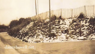
The photo above, was taken in the 1930s,
and shows the view north up Imber Road,
Warminster, from its junction with
South View Road (off to the right).
The sign for South View Road can be seen
near the right side of the picture.
Near the centre of the photo is a tall, hollow,
vertical, iron pole (a “stink pipe”
allowing gas escapes from the sewer).
Snow is on the ground.
During the 1920s allotments existed on the
land beyond the bank (behind where the
chestnut pale fencing is
visible in this photograph). This area was
known as Morley Field in the 1800s.
The photo was taken just prior to the
establishment of the Tank Barracks
at the northern end of Imber Road
(which later became the School Of Infantry).
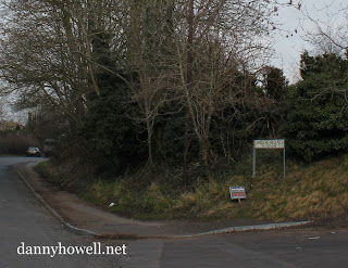
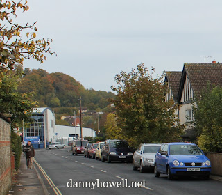
Danny Howell snapped this photo at the
same location on the afternoon of
Wednesday 20th February 2013.
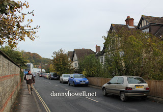
The sign for South View Road has long since
gone, replaced by a sign which reads:
‘Imber Road
Even Numbers 52A – 88.’
What were Nos.1 to 12 South View Road
are now re-numbered (even imbers)
Nos.88 to 66 Imber Road respectively.
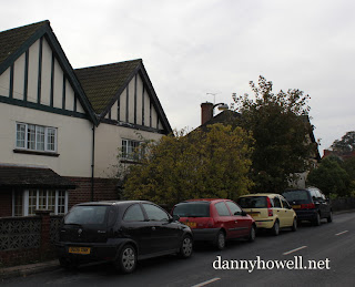
The smaller sign in this picture, a temporary
fixture, advertises Thermaglaze,
installing double-glazing nearby.
The vertical iron pole is still in situ
(slightly hidden by the trees)
and still visible in this photo.
A pavement now exists adjacent the east side
of the road. Behind the trees is now
the residential estate called
Morley Field (built 1986).
What was the School Of Infantry site at
the northern end of Imber Road
is now the Land Warfare Centre.