1880s – 1890s
Our Own Country, Descriptive, Historical, Pictorial, is a six-volume set of books published by Cassell, Petter, Galpin & Co., during the 1880s and 1890s. The writers of the illustrated articles in these books are not credited.
One of the volumes begins with an article about Salisbury Plain and Stonehenge. The first sentence of this article reads: “It is not unfitting that a book in which it is proposed to describe the most interesting and important sites of Great Britain should, in its opening pages, deal with Salisbury Plain.”
Here is an extract from the article, referring to the landscape of Salisbury Plain:
A century ago there was little touch of cultivation about Salisbury Plain. Sheep in the summer, and flock of bustards in the winter, were, in Drayton’s words, the “burgesses of the heath;” and a journey across it, even in fine weather, was not undertaken without some risk of losing the way.*
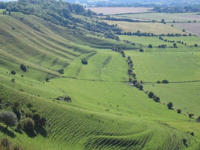
This condition of things has entirely changed. Good and broadly-marked roads traverse the plain in all directions, whilst corn-fields and tilled land have greatly encroached on it, stealing upwards from the surrounding valleys. But the general outline of Salisbury Plain is still sufficiently marked. It is the southern division of the two great divisions of the chalk in Wiltshire.
The northern division forms what is known as the Marlborough Downs, and its escarpments are far bolder than those of Salisbury Plain, from which it is divided by the Vale of Pewsey, which extends across the centre of the county, and is scooped out of the upper-greensand.
The southern chalk district extends from Salisbury in a line bearing north-east, by Amesbury and Sidbury to Easton Hill, where there is a wide view of the Pewsey valley, with the opposite heights of Marlborough, scarred by the Wansdyke. Thence the chalk ranges westward, with a little inclination to the south, as far as Westbury and Warminster; and so returns, in a line bearing south-east, by Heytesbury to Salisbury. All along this border the bolder heights are marked by intrenchments – Battlesbury, Scratchbury, Chisenbury – which overlook the richer country, and served as watch-towers for the ancient people of the plain.
In shape, this plain is an irregular triangle, whilst the length of each side may be roughly estimated at about twenty miles. Of its general character we shall better judge in passing over it toward Stonehenge. The chalk mass of the plain is pierced by the Bourne brook, by the Wily [Wylye], the Nadder, and the southern Avon, all of which meet in the neighbourhood of Salisbury. These river-valleys, in their quiet beauty, their hamlets nestled among trees, their venerable mansions, their broad meadows, through which the stream flows onward between tufts of purple loose-strife and great masses of sword-flag, contrast pleasantly with the open heights of the downs.
It is held, however, that the influence of the chalk is felt throughout Southern Wiltshire, and that the sharp division of the county is between the chalk district generally and that north of the Marlborough Downs, where the land for the most part lies on Oxford clay. Wiltshire is thus divided between “chalk” and “cheese” – for the northern district is a great dairy ground.
*Thus Mr. Pepys and his party, journeying from Salisbury toward Somersetshire, lost their way on the plain, and were obliged to spend the night in a strange town [Chitterne].