
Friday 24th August 2018
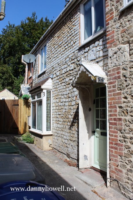
57 Portway, Warminster. Photograph taken by Danny Howell on Friday 24th August 2018.
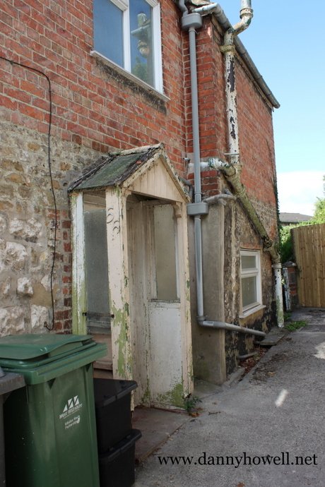
Friday 24th August 2018
57 Portway, Warminster. Photograph taken by Danny Howell on Friday 24th August 2018.
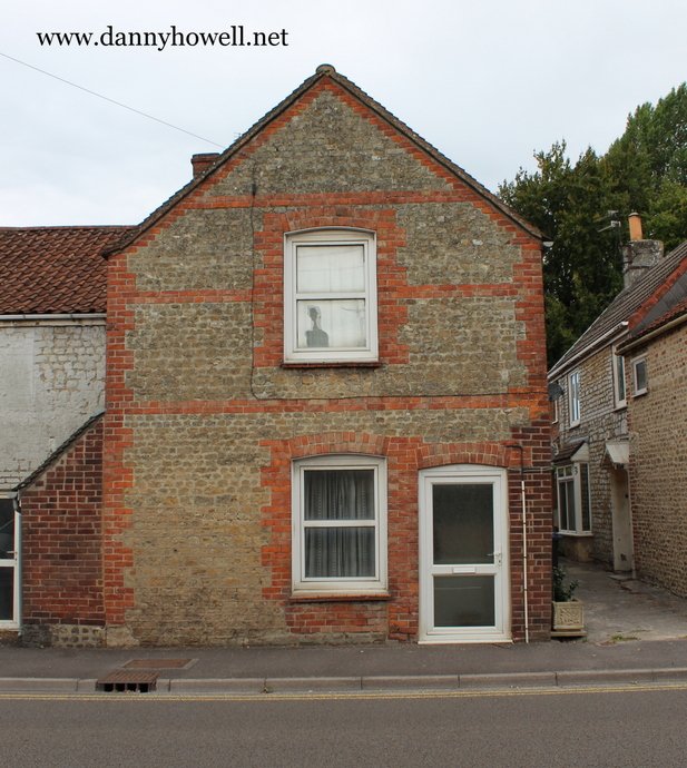
Friday 24th August 2018
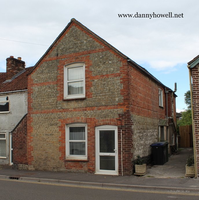
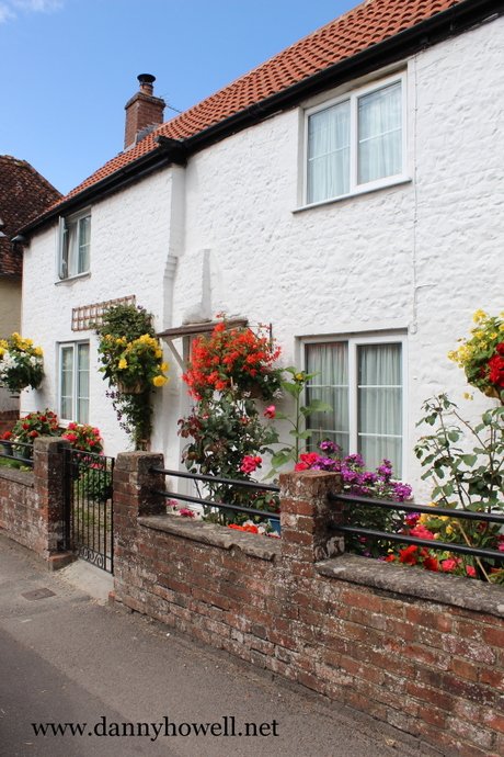
55 Portway, Warminster.
Photographs taken by Danny Howell on Friday 24th August 2018.

Friday 24th August 2018
91 Portway, Warminster. Photograph taken by Danny Howell on Friday 24th August 2018.
Sunday 5th August 2018
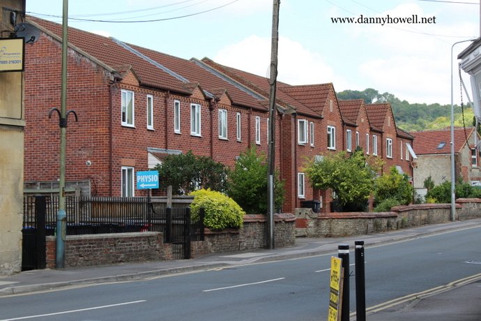
The Grove, Portway, Warminster. Photograph taken by Danny Howell on Sunday 5th August 2018.
Tuesday 23rd May 2017
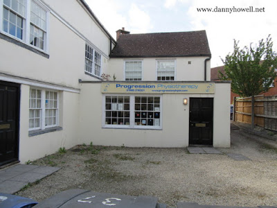
Progression Physiotherapy Ltd.,
5 Portway, Warminster, BA12 8QG.
Telephone 01985 218301.
Email contact@progressionphysio.com/
http://www.progressionphysio.com/
Photograph taken by Danny Howell
on Tuesday 23rd May 2017.
Thursday 27th October 2016

Janet Graham, chatting on her phone, at Warminster War Memorial, Portway, Warminster. Photograph taken by Danny Howell on Friday 27th October 2016.
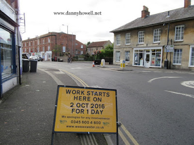
Friday 23rd September 2016
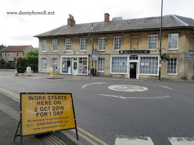
Wessex Water will be carrying out repairs
on and around Portway Roundabout
(junction of Portway, George Street and High Street),
Warminster, on Sunday 2nd October 2016.
The work should be completed in one day.
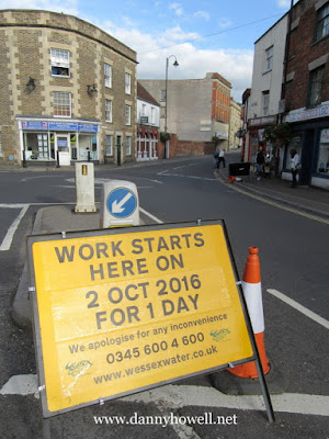
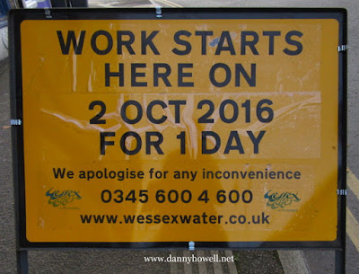
For enquiries, telephone 0345 6004600.
www.wessexwater.co.uk
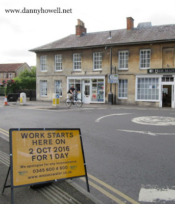
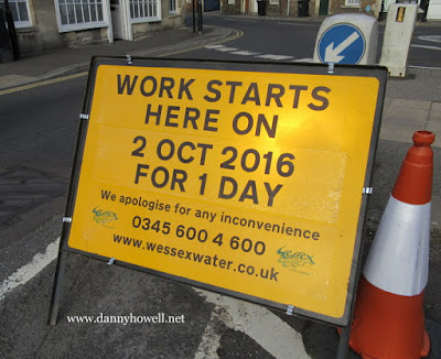
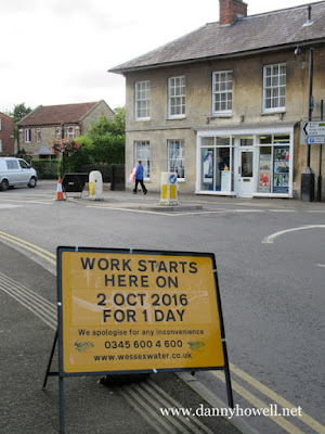
Photographs taken by Danny Howell
on Friday 23rd September 2016.
Monday 7th September 2015
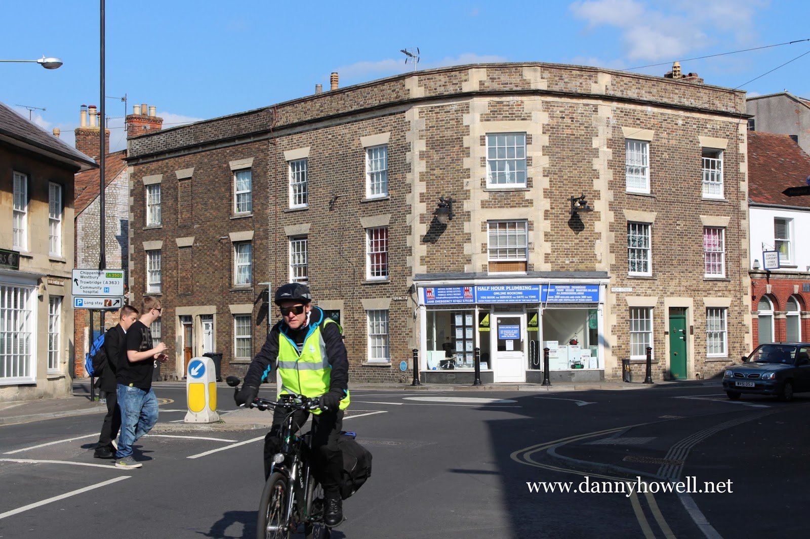
The junction of George Street, Portway,
and High Street, Warminster.
Photograph taken by Danny Howell
on Monday 7th September 2015.
West Wiltshire District Council’s Warminster Town Centre Conservation Area Character Assessment, Informative Document, Consultation Draft/Cabinet Draft, of December 2006, includes the following notes:
RESIDENTIAL AREA 1
This part of the conservation area includes Portway and The Close. Portway runs southwards and is one of the main entrance routes into the town. The Close also runs north to south, but is a smaller, one-way back road.
The manor of Newport was created in the 12th century, however, the road previously known as Newport (now Portway) formed part of a planned extension to the town in the 14th century.
Strong reference to the rural setting of the town and the historically rural nature of the town. Whilst it emerged in the 13th century as a route into the market place and has older origins than High Street or Market Place it is likely to have developed from a relatively low key drovers or access route; has not been consumed by the commercial centre/ uses of the town.
As an important entrance-way into the town centre, Portway has quite a suburban feel to it although it becomes more urban to the south as you get nearer to the town’s retail centre.
The northern end of Portway has a steeply rising wooded backdrop which, along with the low density green (well planted/mature) residential environment which surrounds the conservation area at this point, makes this one of the parts of the town which has retained its rural character.
USES
A large part of the Portway area was once part of the Portway Estate (previously the Newport Estate). Portway House is still the most dominant landmark feature within this area.
In the mid 19th century the railway line was constructed and crosses Portway, interrupting the avenue. This area has always been on the periphery of the commercial centre. Residential is currently the predominant use in this area that is also true of its historic function.
At the entrance to The Close is the Warminster Hospital complex. Positioned to the rear of Portway, these buildings do not have a strong presence on this main route but are a prominent feature on The Close and The Avenue.
This area has also been the location of the fire station for over 100 years although originally located at the southern end of The Close. In the mid 20th century it was found that the original building did not have sufficient capacity to meet demand and a new fire station was built on Portway. The current fire station is outside of the conservation area boundary and does not visually contribute to the character of the conservation area. However, it represents an important function within the town and the original first station building remains architecturally intact.
Between Portway and The Close there are remnants of the town’s industrial heritage and sandwiched between these two residential streets are a Victorian malthouse and brewery buildings.
LAYOUT
The majority of the buildings in this area are terraced properties which front directly onto the highway/footpath, although a number are set back behind small enclosed front gardens.
Portway in the most part is an unusually wide road, which allows for long views and adds to its low-density edge of settlement feel. Large gardens and a number of breaks in the building frontage allowing glimpses of green space or trees is an important feature. The relatively low density of development north of Portway House, gives the impression that the northern part of the area backs onto open countryside.
The southern end of Portway is narrower in width and is characterised by high-density development with narrow fronted terraces and a greater number of three storey buildings. Layers of development become visible and a sense of the busy town centre spills across into Portway.
The Close is a narrow one-way street, consequently cars do not dominate it. Buildings directly abut the road although many are orientated north and south rather than fronting The Close. Buildings are often very spaced out with side gardens bound by high walls. The overall effect is a high sense of enclosure and an intimate feel.
The Close, previously known as Common Close has a narrow entrance off of High Street, which historically was only a pedestrian alleyway with a building terminating the street. With the demolition of that building in the 20th century The Close became a one-way street from Portway to High Street.
ARCHITECTURAL FORM
The scale and form of buildings varies within this area from modest two-storey cottage style terraced properties to three storey wide fronted Georgian style town houses.
The Almshouses are the only single storey terrace. The tall steeply sloping hipped roof ensures that the neighbouring houses do not overshadow the building, and its detailed architectural features give it a strong presence within the street-scene.
Portway House, a grade I listed building, fronted by large wrought iron gates with pillars capped by eagle statues. This is one of the largest and most architecturally interesting buildings within the town. Portway House consists of three wings with the central part being three storeys, dropping down to two storey of either side. Clad in ashlar Bath stone, it stands out as one of the most distinguished buildings in the town.
The walls which front Portway House are also listed in their own right with the front wall and gateway being a grade II*.
Side gables are common, but a number of the feature buildings have steeply pitched Victorian front gables. Parapets are not common in this locality despite being a regular feature on the towns’ commercial streets.
The heights of buildings and roof pitches create a varied skyline that is enriched by the multitude of chimneys.
LANDMARK BUILDINGS AND FEATURES
Whilst a number of buildings or structures stand out within this area due to their size, positioning or architectural detailing, there are 2 key focal points:
The railway bridge, due to its simplicity, rather than being a barrier, acts as a physical gateway into the town.
Portway House.
Other landmark or feature buildings include:
The Almshouses, Nos. 92 -98 (even) Portway.
The War Memorial, set in its small courtyard.
Nos. 83-91 (odd) Portway, Victorian front gable, ornate timber detailing.
Nos. 37 – 43 (odds) Portway, a row of three storey weavers’ houses.
The pub, 49 Portway.
The Hospital (main building), The Avenue.
The Old Fire Station, The Close.
Nos. 2-6 Portway group with 52 and 54 High Street, corner building.
BUILDING MATERIALS
Walls: As is common throughout Warminster a large number of the buildings are clad in rubble stone with brick dressings.
Red brick frontages with stone or timber dressings, are found particularly along the east of Portway and in the southern part of this area. The side and rear elevations are often still finished with the local rubble stone.
Some buildings have been painted or rendered.
Roofs: Clay pantiles are the most common roof materials, with occasional use of slate or stone.
Fenestration: Where the original timber windows have been retained, they tend to be either glazing bar sash windows or narrow glazing bar casements. A number of buildings also have blind windows.
STREETSCAPE
Portway is an unusual wide street, which although not formally planted has the feel of an avenue and a street of some status.
LANDSCAPE
Surrounded by prominent green landscaping with views of mature trees and long green gardens to the rear of the buildings which front the street, Portway has retained a semi-rural feel. There are a number of mature trees in front courtyards which are important to the character of the streetscape and
complement the long views of the attractive landscape setting of the town.
OPPORTUNITIES
In order to retain and enhance the character of Portway the retention of front gardens and boundary walls is considered important.
The reinstatement of these enclosed spaces by introducing gateways where new drives have been created would be beneficial.
The street can accommodate the inclusion of street trees due to its width.
There are a few neutral buildings that do not contribute to the character of the conservation area:
35 Portway, is architecturally bland, but is nevertheless, of an appropriate size and positioned well in terms of its relationship with Portway House. Consequently, if redeveloped the building form should be retained.
88 Portway, late 20th century detached house. neither the materials, the positioning nor the architectural style of this building is suitable for this locality.
Kyngeston Court, architecturally does not positively contribute to the character of the conservation area.
SUMMARY OF KEY FEATURES
Street and Building Layout.
Varying street widths,
Majority of building directly front the highway.
Building Types
Predominantly residential terraces.
Some semi-detached or detached properties
Portway House and No 35, large buildings set in large grounds, multiple occupancy not apparent from the street.
Materials
Mixture of rubble stone and brick, some feature buildings in particular Portway House clad in ashlar stone.
Clay tiles including pantiles, some slate and stone.
Timber sash windows with glazing bars and timber casement windows.
Railings are the most frequent front boundary treatment.
Landscape Features
A large number of mature trees are important to the visual attractiveness of this locality. These are either to the rear of buildings or focused on Portway Lane, 33 and 35 Portway or around the war memorial.
Parking
On street or Courtyard and walled car parks.
Some later creation of frontage parking.
Some rear parking courtyards
Garages are not a common characteristic of the locality.
Streetscape
No historic street finishes or furnishings have been retained in this locality.
Skyline
Viewed against Salisbury Plain the varied nature of the skyline and roof detailing is considered an important feature in this locality.
West Wiltshire District Council’s Warminster Town Centre Conservation Area Character Assessment, Informative Document, Consultation Draft/Cabinet Draft, of December 2006, includes the following notes:
ENTRANCES INTO THE TOWN CENTRE
The edges of the historic town were governed, particularly to the north and the east, by the steeply rising slopes of Salisbury Plain, the route of the River Were to the north west and the low-lying flood plains of the River Wylye to the south.
However, in the 20th century the shape of the town as a whole has been changed significantly due to considerable suburban residential development.
Whilst most of the historic centre has been retained within the Conservation Area with limited pockets of redevelopment, the boundaries of the Conservation Area are as clearly defined on the ground as the historic town limits were.
There are a number of visual and physical gateways into the historic centre including:
Portway – the terraces and semi-detached Victorian and Georgian buildings mark the entrance into the town. This gateway is formed by the sudden rise in the density and urban nature of the buildings.
Church Street – St. Denys’ Church marks the edge of the current and historic settlement. Along with the buildings owned by Warminster School, Church Street visually presents a transition from open countryside into the built up settlement.
East Street – part of East Street is essentially commercial and is contained within the Town Centre Conservation Area. Before becoming Boreham Road, as you enter the Boreham Road Conservation Area the overriding character of the street changes, becoming less dense and domestic in character. This shift in character marks the gateway between the historic town centre and the residential suburbs.
West Street – The extent of the Georgian and Victorian settlement is very apparent travelling into Warminster from the east, due to the sudden change in architecture. The style of development is nevertheless urban rather than suburban in character and clearly marks the entrance into the town centre.